|
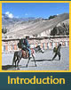
Getting
To Lo Monthang Page 1
TRAVEL
TO MUSTANG
A journey to Upper Mustang usually begins with a flight to the
small town of Jomsom, northwest of Kathmandu. Beyond Pokhara,
the flight path is through the canyon of the Kali Gandaki river,
flanked by Dhaulagiri on one side and the Annapurna range on
the other. At Jomsom, the canyon widens enough to permit an
airstrip.
From
Jomsom, most travelers continue on foot, although it is also
possible to proceed on horseback. The trail climbs northward,
gradually gaining altitude, crossing several passes at 12,000
and 13,000 feet. Before reaching Lo Monthang, there are several
small villages. Then, after a trek of about five days (fewer
for those on horseback), the traveler gains the first distant
sight of Lo Monthang, set in a plain, girdled by its wall.
Unlike the Annapurna Circuit and the Everest region, Mustang
has virtually no lodges or teahouses. Under the terms by which
Mustang was first opened to visitors, local people were denied
permission to turn their homes into lodges. Travelers must
generally bring a crew and cook as well as all provisions
and fuel, and be prepared to camp along the route as well
as outside of Lo Monthang.
|
(click
photo to see larger image)
 |
|
1.
Schematic map of Nepal showing airstrips. The entry point
for Mustang and Lo Monthang is Jomsom, north of the Annapurna
range.
|
 |
|
2.
Jomsom airstrip, the starting point, with Short Takeoff and
Landing Aircraft (STOL).
|
 |
|
3.
The main street of Jomsom.
|
 |
|
4.
Nima Wangdi -- the Loba horseman who will transport our equipment
to Lo Monthang. The ponies are the same sturdy stock used
by the Mongols when they conquered much of central Asia and
Europe. The Loba are the Tibetan people who settled Mustang.
|
 |
|
5.
Lead pony of a goods train with traditional Loba horse dress.
|
 |
|
6.
Dhaulagiri, one of the Himalayan 8000-meter-high mountains
flanking the Kali Gandaki river valley that leads to Jomsom.
|

|
|
7.
The Kali Gandhaki river basin. The first day of the trek from
Jomsom toward Lo Monthang proceeds up the river basin.
|
 |
|
8.
A goods pony "train" passing us in the river basin.
|
 |
|
9.
Kagbeni village with Dhaulagiri in the background. Kagbeni
marks the start of the "restricted" area of Mustang,
which requires a special trekking permit for travelers, other
than citizens of Nepal. The green barley fields are the result
of concentrated irrigation.
|
 |
|
10.
Street scene in Kagbeni.
|
Go
forward to Page 2
[Contents]
[Introduction] [Jampa]
[Thubchen] [Luri]
[Site Index] [Home]
Copyright © 2003 Philip and Marcia R. Lieberman
Use Limited to Non-Commercial Purposes
|